Home
Resume
Projects
Contact
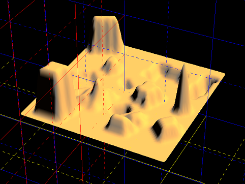
IGNoble
Cartography software in C and OpenGL.
Loads National Geographic Institute (IGN) maps and output them in 3D, using Bezier surfaces.
Direct application of graph theory and graphics code optimization awareness.
Category
IT
(20)
AS3
(2)
Git
(3)
IDE
(1)
FlashDevelop
(1)
Productivity
(1)
Project Management
(1)
MS Project
(1)
Social Network
(1)
Tuning
(6)
video games
(2)
Wii
(1)
Xbox 360
(1)
Web
(1)
Windows
(2)
Work
(1)
sourigna.com
(1)
Archives
December 2013
November 2013
June 2013
September 2012
May 2011
April 2011
March 2011
February 2011
December 2010